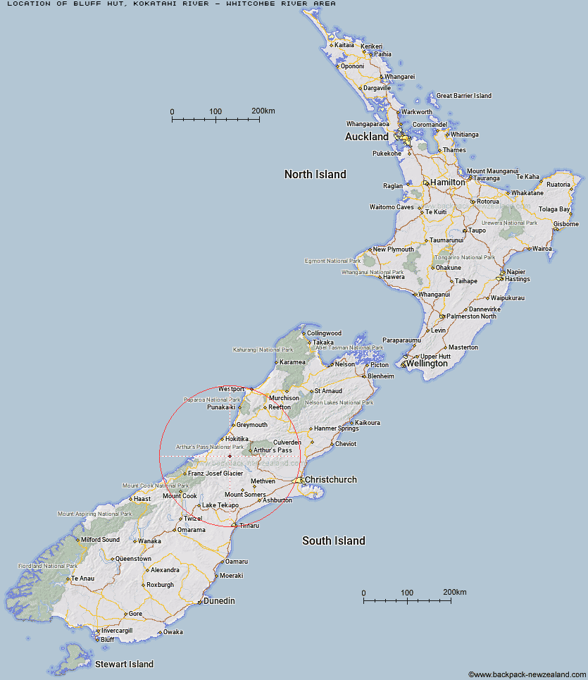
Topo Map showing location of Bluff Hut
This information is sourced from DoC, LINZ and Openstreetmap. Some of the hut photos are mine and the rest are from DoC. I will be adding an upload feature soon so people can photos of .Bluff Hut.
Basic info: basic six-bunk hut in the Hokitika area.
Latitude: -43.0467818695
Longitude: 171.126903716
Location: Kokatahi River - Whitcombe River area
Area: West Coast
Type of Hut: Standard
Tracks: Toaroha, Hokitika, Lower Whitcombe Track
Map: BV19 Topo Map | Road Map
Does this hut still exist? Have any more information? Contact
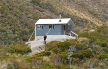
Image: DoC
Scroll down to see a topographical map and road map showing the location of Bluff Hut
[ A ] [ B ] [ C ] [ D ] [ E ] [ F ] [ G ] [ H ] [ I ] [ J ] [ K ] [ L ] [ M ] [ N ] [ O ] [ P ] [ Q ] [ R ] [ S ] [ T ] [ U ] [ V ] [ W ] [ Y ] [ Z ]
Closest 20 Huts to Bluff Hut
These are as the crow fliesFrisco Hut 2.12km Poet Hut 2.39km Sir Robert Hut 2.65km Toaroha Saddle Bivouac 3.98km Top Toaroha Hut 4.32km Frew Saddle Bivouac 4.4km Serpentine Hut 5.35km Mullins Hut 5.58km Crystal Bivouac 5.98km Mungo Hut 6.17km Frew Hut 6.79km Canyon Creek Bivouac 7.15km Yeats Ridge Hut 7.17km Gerhardt Spur Bivouac 8.57km Top Kokatahi Hut 8.69km Adventure Bivouac 8.91km Cedar Flat Hut 9.42km Rapid Creek Hut 10.21km Price Flat Hut 11.98km Price Flat Hut 12km Unknown Stream Hut 12.11km Pinnacle Bivouac 12.81km Crawford Junction Hut 12.98km West Mathias Bivouac 13.66km Moa Stream Hut 14.21km Boo Boo Hut 14.4km Moraine Hut 14.85km Centennial Cabin 14.98km Urquhart's Hut 15.52km Mikonui Spur Bivouac 15.57km Mathias Hut 15.61km Price Basin Hut 16.23km Explorer Hut 16.35km Wilkinson Hut 16.53km Weka Burnet Bivouac 17.18km Moa Hut 17.29km Top Crawford Hut 17.5km Healey Creek Hut 17.54km Neave Hut 18.94km Park Morpeth Hut 19.37km